April flowers

Liz and I made a pact to “experience Spring” this year – to get out into wilder lands to see and feel the progression of wildflowers, leaf-outs, and scents.  It is something that was very much a part of me in Minnesota, but I haven’t made the same connections to the turning of the seasons here.

These flowers are from two hikes, Dimple Hill (1500 ft, north side of Corvallis) on Easter, and Finley Wildlife Refuge (8 miles south of town) last Sunday.

Dimple Hill:

Fairyslipper (Calypso bulbosa), a surprisingly common orchid

Western Trillium (Trillium ovatum)

Finley:

Pacific Bleeding Heart (Dicentra formosa)

Milkmaids (Cardamine californica)

White Fawn Lily (Erythronium oregonum) - a relative of Minnesota's trout lilies

Tall Oregon-grape (Mahonia aquifolium)

Oregon Iris (Iris tenax)

Western Buttercup (Ranunculus occidentalis)

Yesterday we drove to Portland to pick up a nucleus hive – our first bees this year.  We stopped at the arboretum to explore their collection of blooming Magnolia trees.

Magnolia!

A wonderland of petals

All shades of white and pink

Posted in Uncategorized | Comments Off on April flowers

Mostly cloudy with a 90% chance of rainbows

We’re in a pattern of April showers – or maybe more like March showers as it hasn’t gotten above 50 the past three days.  But the skies are beautiful, and aside from the alternating downpours/hail showers and full sun, afternoons usually bring rainbows.  I’ve seen six in the past three days.  There should a be a picture of a rainbow here but unfortunately I haven’t had my camera with me.


Posted in Uncategorized | Comments Off on Mostly cloudy with a 90% chance of rainbows

Flat-headed Cone Borer

I found this brilliant little beetle on top of our Sluggo jug in the greenhouse, and he calmly posed as I arranged him for photos.  My entomologist friend Kojun identified it as Chrysophana placida, the Flat-headed Cone Borer, which apparently bores into cones in its larval stage.  As usual, you can click on the photos for larger versions.

Posted in Uncategorized | Comments Off on Flat-headed Cone Borer

Graduation vacation

Last Wednesday Liz finished her last final, the official end of her undergraduate career.  In celebration, we set off on a long weekend adventure, a big circle north into Washington and back.

Thursday, March 22

Left the house a bit after 2, stopping in Newberg to buy snowshoes that I found on Craigslist.  Picked up swarm lures at the bee store.  Delicious Thai dinner with friend Jess in northeast Portland before the Girlyman show.  They just keep getting better and better, and the Alberta Rose Theatre has great acoustics.  Someday I want to find the kind of creative, authentic expression of self that characterizes the Girlyman quartet.  Stayed with Jess at her new studio apartment.

Friday, March 23

Shared songs with Jess in the morning, then bought some needed supplies at outdoor shops while Liz finished her Food Corps application.  Set off around 3 pm for Ape Cave, a 2+ mile long lava tube on the south flank of Mt. St. Helens.  We elected to try the “more challenging” upper section of the cave.

Inside Ape Cave. Striations on the walls mark various lava flow levels.

Eight-foot lava falls - supposedly the most challenging part of the hike.

The sign warned us about the lava falls to climb and rock piles to climb over, but didn’t mention exactly how many or how large of rock piles. The cooled lava is very grippy rock, even when wet, so we didn’t have too much trouble though the going was slow at times.  The cave is a tube ranging from eight feet to over twenty feet in diameter, with interesting patterns on the walls and ceiling.  It is completely black inside, enough that our headlamps didn’t seem very bright.  Thankfully I bought an extra-bright LED flashlight in Portland that did a good job of lighting up the whole cave.

The most difficult part proved to be the exit, as the ladder/staircase led out onto steep, icy snow.  But with the help of grippy rock handholds and kicked steps, we joined Jupiter and Venus shining through the last light of day.  We camped at Seaquest State Park, arriving around 11 pm.

Saturday, March 24

While Liz caught up on sleep from finals week, I hiked the perimeter of the park – about three miles through mixed hardwood-conifer forest.  Seaquest doesn’t really have any natural attractions – it seems to exist solely to house the hundreds of campers that come to visit Mt. St. Helens.  Even so, it was a beautiful morning in a forest awakening to spring.  We left around noon, driving to North Bend, east of Seattle, and from there 17 miles up the most potholed gravel road I have ever seen.  In many places there were too many potholes to dodge them all, and we bounced along at 5 mph until the next open section.  I was glad to have the Subaru as we drove through deep snow and rocky washes that stopped smaller cars.

We were told to bring snowshoes, but earlier weekend visitors had packed the trail enough to walk without sinking in.  It’s 4.5 miles from the trailhead to Goldmyer Hot Springs, mostly walking up a closed road along the river, in the shadow of some amazing peaks.  The Cascades are much more rocky and jagged up here, compared to the tree-covered slopes of Oregon.

Trail to Goldmyer Hot Springs

Along the Middle Fork Snoqualmie River.

I was surprised to run into my old Carleton friend Jannel on the trail, hiking out with her coworkers from a wind energy company.  I would have loved to catch up a bit more, but with others waiting we continued our respective treks, Liz and I walking over deepening snow as we climbed farther up the valley.

This was my first time snow camping, but with the hard-packed snow and above-freezing weather it wasn’t much different than camping on solid ground.  Will, the hot springs caretaker, pointed us toward the campground and gave us a bucket to hang our food out of reach of bears.

Boiling tortellini for dinner.

We hiked up to the springs after dinner, joining about 6-7 others soaking by candlelight.  The main pool is in a cave extending 25 feet back into the rock, with the hot water emerging from the wall about half way back.  There is a wood bench at the far back – the best place to be as it is steamy but not too hot.  We sang John Denver and other songs with some folks from Seattle before sliding down the hill to our warm sleeping bags.  (I bought a new 15-degree down bag a month ago, and I came to love it on this trip.)

Sunday, March 25

Campsite in the snow.

Old-growth forest on the trail between the campground and hot spring.

Peering out from the cave entrance.

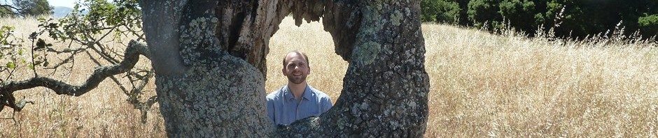
Mark in the middle pool.

We were the only ones at the hot spring when we hiked up in the morning, and we spent a good couple of hours singing in the resonant chamber of the cave – old A Cappellicans songs and other favorites.  Around noon we reluctantly bid farewell and began the long hike out.  It went quickly, despite light rain falling for the latter half of the walk.  We ate dinner with Liz’s aunt, uncle, and cousin in Renton, then drove up to the Fremont neighborhood to spend the night with Jenny (my cousin) and Ted.  They are retrofitting their basement as an apartment, so we had a whole floor and queen bed to ourselves which felt amazing after two cold nights in a tent.

Monday, March 26

After a few Seattle-area stops, we had lunch in Olympia and headed west to explore the Washington coast.  Unlike Oregon, where there are beaches and state parks every 5-10 miles, the southern Washington coast is mostly privately owned and inaccessible, so we continued on to Cape Disappointment at the mouth of the Columbia River where we set up camp in light rain and walked a few miles along the beach as the rain and wind picked up.

Blue sand beach at Cape Disappointment.

Warning for fellow beachcombers.

Jetty at the mouth of the Columbia River.

We were camped next to a drunk fellow, who kept us awake for a few hours with his loud coughing and throwing up.  He did eventually fall asleep, leaving us to rest peacefully until morning.

Tuesday, March 27

Heading south from Cape Disappointment, we crossed the four-mile bridge over the Columbia River and returned west to Fort Stevens State Park, an old military installation with many acres of mudflats where we found lots of shorebirds, three bald eagles, a great blue heron, and a small collection of bufflehead ducks.

Near the start of the four-mile Columbia River bridge at Astoria.

Elevated south end over the shipping channel.

The Flex Shine, an empty bulk ship heading empty to Portland to load grain bound for China.

Just south of the river mouth a 100-year-old shipwreck remains embedded in the beach.  Personally I found the sanderlings much more exciting than the rusted metal.  Sanderlings are one of the cuter birds, moving at double-speed on their little legs running up and down the beach with the waves.

Shipwreck at Fort Stevens State Park.

Sanderlings!

I'm not sure what they were eating.

Posing with someone else's sand art.

After Fort Stevens, our next Stop was Ecola State Park, where we hiked a 2.5-mile loop to the top of Tillamook Head through old-growth Sitka Spruce forest.

Boiling sea, stormy sky at Ecola State Park near Cannon Beach.

Abandoned Tillamook Head lighthouse, 1.2 miles offshore.

Bald Eagle at Ecola Point, our fourth eagle of the day.

Wind-stripped Sitka Spruce with near-perfect symmetry.

South from there, we stopped at a few overlooks before ordering delicious pizza at the Pizza Garden in Nehalem.  The wind and rain really picked up as we drove the final 2 1/2 hours through Tillamook and back to Corvallis, where we stopped at Block 15 for a celebratory pint.

Chalk reflections on our journey at Block 15.

Posted in Uncategorized | Comments Off on Graduation vacation

Record-breaking weather

The atmospheric river returned on Tuesday, but this time we were on the northern, cold side.  The south coast got the flooding.  We got cold rain and then, starting at 3 am yesterday, 22 hours of continuous snow.  The total would have been over a foot if it had been a few degrees colder.  As it was it melted as fast as it fell until sunset, when it piled up to about 6 inches deep before finally ending at 1 am.  Many people lost power due to snow-laden trees falling on power lines.  Liz took her last final from 8-11 at night, and we went to the one pub still open at midnight in the snow for a celebratory beer.

Records broken:  Daily snowfall: 5-6″.  Old record 2″, also highest daily snowfall ever recorded in March.  Low maximum temperature: 36.9 degrees.  Old record 39.

As I write this, the sun is shining and snow is melting off the trees.  Liz and I are headed to Portland today for a Girlyman concert then up near Seattle to explore some new hot springs.  Look for pictures next week some time.

My office building, Gilmore Annex.

Cherry tree on campus in full bloom toppled by heavy snow.

Snow starting to stick, around 9 pm.

Downtown just after midnight.

20 second exposure looking northeast from chicken coop, 1:15 am

Picnic table this morning, 5-6 inches of snow

Barn and solar shower

Looking west on Nash Ave. Roads starting to melt off.

Posted in Uncategorized | Comments Off on Record-breaking weather

Peak winter on the mountain

While Minnesota has 80 degree days, Oregon has been having January weather – storm after cold rainstorm with occasional snowflakes down to the valley floor.  At the moment we have a winter weather advisory, with 1-2 inches of wet snow possible overnight.

A month ago we drove up Marys Peak, but three cold storms dropped close to three feet of snow on the summit since then.  Last Sunday Ali and I decided to ski to the summit in a mix of showers and sun.  It may have been one of the coldest days of the year on the summit, starting out at 21 degrees with a high of 28.

Road report:  Passable to Connor’s Camp (2600 feet) in an AWD Subaru Forester, though I don’t think we would have made it in anything less.  (Snow is probably much deeper after tonight’s storm.)  One lifted truck made it almost to the upper gate.  Beyond that the snow is around 2-3 feet deep with deeper drifts – I would estimate that no wheeled vehicle will reach the top until mid-April at least.  On the plus side the road makes an excellent ski trail!

We made it - despite bottoming out and spinning in a couple of spots.

It’s 1500 feet up in about 4.5 miles to the summit, and the first three miles is a steady 6% grade.  We broke trail most of the way – a good cardio workout.

Breaking trail on the three-mile uphill.

The valley showers are mountain snow squalls, and up at the summit they are more like blizzards with 30 mph winds, freezing fog (since we are actually in the cloud), and whiteout blowing snow.  Farther down the snow falls peacefully.  We had 45 minutes of clear skies before it started dropping pea-sized snowballs a half hour from the summit.

Clear skies on the west shoulder of the mountain.

Final push to the summit in near-whiteout conditions

The only shelter from the wind.

We started to eat our lunch on top, but fog and blowing snow quickly froze our wet hands in the 9-degree wind chill (24 degrees, 21 mph wind gusting to 30), and we decided to scurry down and eat in a quieter spot.  But just as we snapped into our skis the storm broke, revealing an amazing palette of blue, a thousand shades of gray and white, and forest green.

Clear skies! All the way to the ocean.

It’s hard to believe that the only thing separating deep winter from lush green forest is a half mile of distance and 2000 feet of elevation.  Coming from a land where winter extends for hundreds of miles, I’m still not used to it.

Ali and the blowing snow.

Southward through the edge of the storm.

The road to the summit had completely drifted in on the southeast side, driven by the northwesterly storm winds

Skiing on the edge of the world. Hard to believe there's a road under there...

Frosted trees, looking south.

Down from the summit.

Ali descending.

We stopped to eat at the campground, where there was amazingly not a breath of wind despite being only 400 feet lower and a half mile away from the summit where the gale was still blowing.  28 degrees can feel warm in calm sunshine.

Stopped for lunch at the campground.

Immaculate snowscape.

Looks more like claymation than reality...

From the campground we had a three mile glide back to the car, just steep enough to require no effort but not enough to need to slow down.  There are few things more fun than a half-hour ski glide!

Thanks to Ali for a few of the pictures and for sharing the adventure with me.  Thanks to my Subaru for living up to its reputation and getting us there.

Posted in Uncategorized | Comments Off on Peak winter on the mountain

Winter on Marys Peak

I try to get up Marys Peak at least once a month.  The weather there is truly unique, perhaps typical of mountaintops elsewhere.  The mountain sticks up high enough into the windy layers of the atmosphere that weather conditions are hardly affected by night and day.  If it is warm aloft it can be 50 degrees all night in December.  If it is cold aloft it can start out at 24 and only get up to 27 despite bright sunshine.  The latter was the case yesterday when we set off for a hike, from Conner’s Camp (2600 feet) up to the summit (4100 feet).

Road note:  I often check Google for Marys Peak road conditions and usually find my blog among the top hits, so in case anyone else is checking the road is currently open to the top, with snow and ice above 2500 feet.  We didn’t drive to the top as we were aiming for a longer hike, but we saw a Prius up top so it appears that clearance is not an issue for now.

A cold showery system brought 1-2″ of snow down to about 1500 feet on Saturday, giving a beautiful frosting to the evergreen foliage of the rainforest understory.

Snow on salal among tall Douglas firs


Rock outcropping halfway up

Near the summit we found a forest of trees all bent at the bottom.  It appears that deep snow, or perhaps a landslide, flattened them when they were small, and they reoriented to grow upward.

Winter above, spring below. Looking east over the Willamette Valley.

Southwest toward the ocean amid shifting wisps of cloud and a sun halo.

The weather report from the summit said 27 degrees and no wind, but since it is almost never wind-free up there I guessed that the anemometer must be iced up.  Indeed it was.  Everything near the summit – antennas, fence, branches, blades of grass, even rocks, had 2″ of snow on the windward side, west-northwest by the look of it.


Iced-up anemometer

Elizabeth on top, looking south

Someone built this snow hut along the trail

We looped back by a different trail, passing a few other hikers.  About six miles in total.  This was the last day of the annual contra dance weekend, and we had friends staying with us from Portland who came to dance.  We aren’t hardcore enough to dance all weekend, but we did have a great time at the open evening dance, with bands Wild Hair (from Portland) and Perpetual E-Motion (all the way from Maine).  PEM was just two guys with an electric fiddle, electric guitar, didgeridoo, footpad percussion, and a lot of loop pedals.  They made a full, energetic sound that was a joy to dance to.

Onion seeds are germinating in my room – when they sprout they will go in the greenhouse to grow until late April when they will go in the ground.


Posted in Uncategorized | Comments Off on Winter on Marys Peak

Ski break

Last Sunday we headed 90 miles east to Santiam Pass for a five-mile ski loop.  There are lots of trails in the mountains, but only the highest have adequate snow in this somewhat anomalous winter.  At 4800 feet the snow is three feet deep, but five inches of rain on top of the snowpack has hardened the surface into a crust strong enough to walk on.  Not ideal skiing conditions, but bright sunlight and a temperature in the low 40s helped to soften the top inch enough for ski traction.  This was Liz’s third time on skis, and all three times have been in somewhat challenging icy or slushy conditions.  I think she is learning quickly, getting her “ski legs” as she says.

Looking south toward Mount Washington

Trail with snowshoe and sled tracks. We met the campers who had pulled their gear in on sleds.

Elizabeth on the south leg of our loop

Looking north toward Three-fingered Jack. I climbed up this knoll to ski down into the bowl in front of me.

Interesting "flock" of clouds behind me next to Hayrick Butte, looking west. These were the first harbingers of an incoming rain system. In another two hours it would be overcast, and we drove home into ever-cloudier skies, reaching the first drops of rain just before Corvallis.

Another amazing cloud formation - Liz called this the "dragon cloud."

This is the time of year in Oregon when the rain keeps falling and the temperature stays cool, but nature begins to show signs of spring.  Crocuses are blooming, and on nights above freezing we can hear a chorus of frogs in the wetlands to the south.  We planted our first lettuce and radishes last Saturday, in the greenhouse.  With luck they will be ready in early April.

Posted in Uncategorized | Comments Off on Ski break

All for a hot shower

Last Saturday (1/28) Kelly suggested a trip to Cape Perpetua.  I’ve been there four times already, but it is always a beautiful destination, especially on a rare (or not-so-rare this winter) clear day in the rainy season.  It is hard to believe with the 55-degree weather and everything still growing that it is in fact January…

Sea anemones in the Cape Perpetua tidepools

Strange root pattern, probably formed when roots grew into a now-decayed stump.

Kelly and Rosalie at the overlook

Sunset over the Pacific

After a two weeks of wet, including the epic flood, our weather has returned to anomalously dry and clear.  This time we had enough wind across the mountains to keep the air mixed and prevent a cold foggy inversion from forming.  As of today (2/5) we have had four bright clear 55-degree days in a row, with one more forecast for tomorrow.  Liz and I hiked up Bald Hill Friday afternoon, a few minutes too late to catch the sunset though not too late for a good glow.

Prior to that I inspected our beehive.  Probably due to a poor queen laying insufficient quantities of brood, and possibly exacerbated by too-wet conditions in the hive, our colony has dwindled to a cluster of about 70 bees surrounding the queen.  They almost certainly won’t make it to spring, though they are leaving plenty of honey that we can use to jump-start our bees this year.

Bald Hill just post-sunset, 2-3-12

Afterglow

With the clear days, my solar shower finally got hot enough – plenty hot at 134 degrees.  That inspired me to finish the project, attaching a showerhead and setting up our old tub with a drain into the chicken yard.  I decided to add an enclosure with shower curtains for some measure of privacy, as the shower spot is in view of some of our neighbors.

After three clear days

Shower completed. We hung shower curtains from the metal pipe a few minutes after taking this picture.

Mark and his project.

Posted in Uncategorized | 2 Comments

Riding the Atmospheric River

It has certainly been an interesting week in Corvallis weather-wise.  I often complain how boring the weather is here relative to Minnesota, but we do occasionally see extremes.

Last Sunday Liz and I drove 85 miles on icy/snowy roads to Breitenbush Hot Springs, where we spent a most relaxing day in the natural hot pools.  There is perhaps no better weather than snow showers for sitting in 105-degree water.

Corvallis got about two inches of snow Sunday night, creating the beautiful scene that appears on average once a year here.

1-16-11, two inches of snow in Corvallis

Bees in the snow. They are alive under there, albeit in a small cluster.

We went hiking at Finley south of town to celebrate the snow.  I was amazed to find a flock of golden- and ruby-crowned kinglets flitting about.  They spend the winter here and must find enough insects to eat.

Hiking at Finley Wildlife Refuge south of town

Fun in the snow...

On Tuesday a stationary front formed along the Columbia River.  To the north Seattle had heavy snow and ice.  Portland saw light to moderate rain.  Corvallis was stuck in the center of the “atmospheric river” – moisture pouring onshore south of the front accompanied on Wednesday by high winds – up to 110 mph on the coast though we didn’t get much over 25 mph here.  It rained for 60 hours – 2 1/2 days – without stopping, totaling 5.5 inches here and over 12 inches in parts of the coastal mountains.

All that rain added to 2-3 inches of water locked in snowpack created an epic flood on rivers draining the coast range.  The Marys River crested at 21.5 feet, five inches above the old record though in some areas with a narrow channel it was more like two feet higher.  Our friend Lisa (source of our delicious local milk) lives right on the river.  The water flowed through the barn and shop but stopped about 10 inches below the floor of the house.  Plenty of mess but relatively little damage, thankfully.

Marys River at record flood stage flowing across Bellfountain Road. 1-19-11

Lisa and Rachel moving 1000 chickens to higher ground

Our chicken yard after 5.5 inches of rain

Bee Creek on our property

On Friday, with the water low enough for me to drive through, I spent the morning at Lisa’s place washing out the shop building that flooded.

1-20-11, driving down Bellfountain, water five inches down from crest

Looking north on 13th Street from Lisa's place. I didn't come that way...

Lisa and the flood

Farm reappearing, water about 12 inches down from the crest here.

Looking south on 13th St./Fern Road. Rachel (with the 1000 chickens) facing the camera, Lisa looking away.

Heading home via Grange Hall Road, water about 8" deep but not moving fast here.

Our friends Eva and Jesse have a homestead in a valley out near Alsea.  The road to their place was closed until Saturday morning by landslides and fallen trees.  When we couldn’t reach them, we decided to go check on their place.  We were amazed that the house, only 4-5 feet above Honey Grove Creek, didn’t flood, but the raging water did wash out the roots of a 18″ diameter alder tree that then fell on their roof.  As we didn’t know if they were in the area or away traveling, we cut the tree where it was resting on the roof, found a tarp to cover it with, and dried things out a bit inside.

Tree partially removed, damage revealed.

Top half of the fallen alder.

Ceiling pushed down inside.

As it turned out, they were in Portland but hadn’t checked their voicemail for a few days and weren’t aware of the storm down here.  Jesse came through on Sunday and I helped him remove the rest of the tree and get the roof somewhat more permanently repaired.

Jesse working on the trunk, standing on the roof of their lean-to/wood storage area.

Broken roof truss inside

Truss repaired

Roof repaired, just needs shingles

We returned to a delicious pesto-roasted home-grown chicken prepared by Elizabeth and hot tub heated by John.  Not a bad way to end a rainy day of chainsawing…

The atmospheric river is forecast to return this Tuesday-Thursday, so there could be more flooding.  At present it is expected to be nowhere near as bad as last week.

Posted in Uncategorized | Comments Off on Riding the Atmospheric River